Drone-based Infrastructure
Assessment
The solution utilizes UAVs with remote sensing and computer vision to efficiently evaluate structural vulnerabilities, enabling faster, cost-effective damage assessment and disaster management before events like earthquakes.
Why Needed
To assess the vulnerability of buildings and civil structures through a faster and more scalable approach than traditional methods to enable disaster mitigation well ahead of disaster events like earthquakes.
Technological Innovation
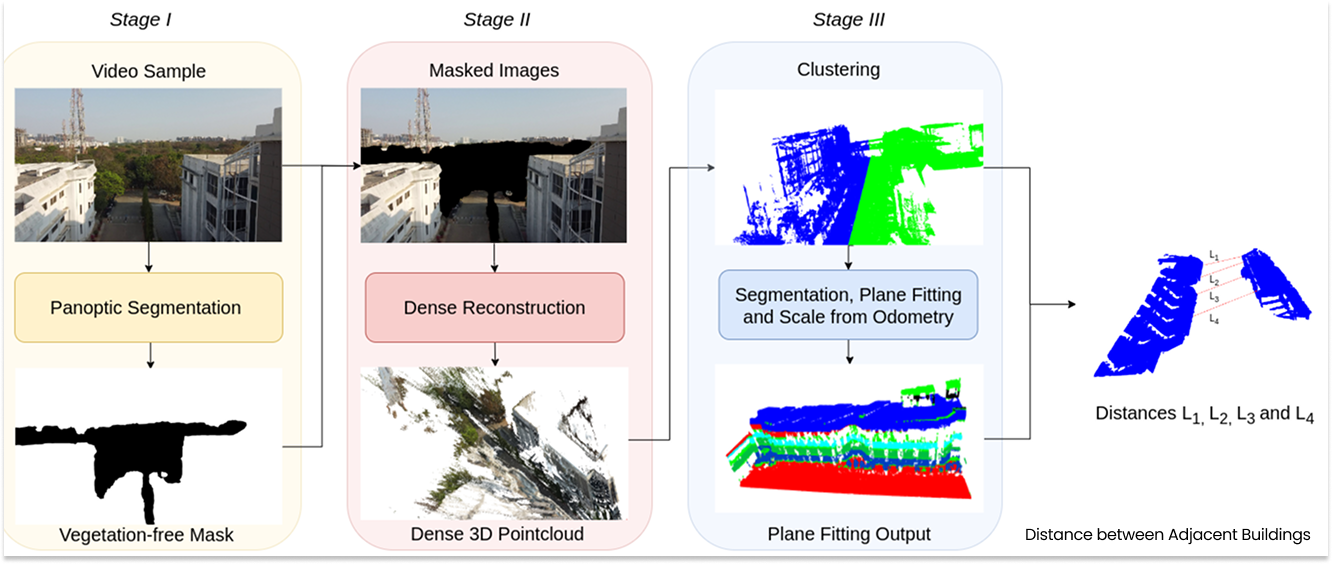
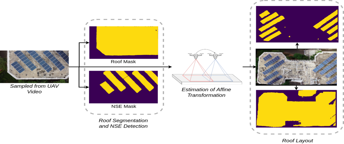
The system enables rapid and automated infrastructure assessment by collecting high-resolution RGB images and sensor data using drones (UAVs), followed by post-processing through a custom ML library to estimate key seismic structural parameters. The specific ML based modules are:
- Window Detection Module
- Storey Count Estimation
- Roof Area Estimation
- Roof Layout & Occupancy Estimation
- Distance between Adjacent Buildings Module
- Crack Detection
- Building Tilt / Slope Estimation
Application Sector
Buildings, Infrastructure, Disaster Management.
Socio-economic Impact
Significant reduction in cost and time large-scale assessments that once required extensive manual inspection can now be performed swiftly and efficiently, enhancing disaster preparedness and response across the country.